news
'East
& Southeast Asia Regional Seminar
on Flood Hazard Mapping, 2008'
in Guangdong, China from 1/30-2/1, 2008The International
Centre for Water Hazard and Risk Management (ICHARM) and the Office of State Flood
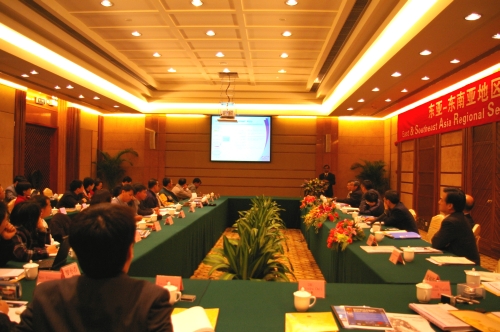
Control and Drought Relief Headquarter, China, (SFDH) co-hosted the "East
& Southeast Asia Regional Seminar on Flood Hazard Mapping, 2008" with
support from the Japan International Cooperation Agency (JICA). Following the
first seminar early February 2007 in Kuala Lumpur, Malaysia, this second regional
seminar was held in Guangdong, China, from January 30 to February 1st. The annual
seminar is part of the follow-up program for researchers and engineers after attending
JICA's region-focused training course entitled "Flood Hazard Mapping,"
whose implementation is commissioned to ICAHRM. Former participants of the 1st-4th
Flood Hazard Mapping training courses were invited to the seminar from several
different countries (China, Vietnam, Cambodia, Malaysia, the Philippines, Indonesia,
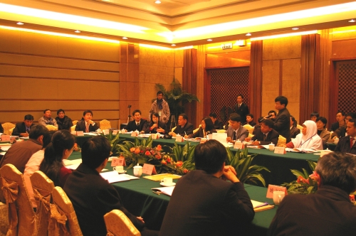
Laos, Thailand). The principal aim of the seminar is two-fold;
presentations on each country's current status and discussions for information
sharing and problem solving. The participants first reported their activities
after the training courses in their home countries regarding the production and
dissemination of flood hazard maps. Then, they shared information and experience
about various issues around flood hazard mapping, such as cases of successful
implementation, problems they face, effective use of flood hazard maps. Discussions
were followed to find solutions to the problems brought to attention. In addition,
opinions and requests were heard to conduct more effective training courses from
the next year on. Besides the presentations and discussions, special lectures
were provided inviting two guest speakers; Dr. Manzul Kumar Hazalika, associate
director of the Geoinformatics Center, Asian Institute of Technology (AIT), and
Dr. Li Na, senior engineer of the China Institute of Water Resources and Hydropower
Research (IWHR).
The following shows the schedule
of the second regional seminar: Day One (January 30)
Inaugural
ceremony
Presentations on flood disaster statistics and current situations
Presentations on current flood hazard mapping practice in each country Day
Two (January 31)
Special lecture by Dr. Mansul Kumar Hazarika, AIT
Introduction on the field survey
Field survey on the flood control system
of the North Pearl River Day Three (February 1)
Special lecture
by Dr. Na Li, IWHR
Round table discussion by all participants
Presentation
on two pilot studies on flood hazard mapping in China
Q&A session
Closing
ceremony
In the first regional seminar,
former course participants reported on their flood hazard mapping projects. One
of the major focuses in this second seminar was to see how much progress was made
in their projects from the previous status reported in the first seminar, as well
as what problems they face to move on with their projects. Major
progress from the previous year has been achieved in two countries; China and
Malaysia. Flood hazard maps of different types have been produced for more areas
in those two countries; more than 200 kinds for 36 areas in China and several
kinds for two areas in Malaysia. Also, in both the countries, more realistic conditions
are set using target areas' information and past disaster records to conduct flood
simulation prerequisite for the production of anticipated inundation area maps.
They are also working on data collection and database development to produce more
effective flood hazard maps. At this moment the two countries have only prepared
such maps for public offices. In Cambodia and Indonesia, flood
hazard mapping projects have been in progress with overseas research institutes.
So far, anticipated inundation area maps have been completed for the study areas.
Joint projects of this kind should be a promising option for countries that face
financial as well as technical difficulty preparing flood hazard maps independently. Thailand
is another country which is earnestly promoting flood hazard mapping. The country
has already completed anticipated inundation area map for the study area, and
are planning to install sign boards with flood hazard maps on in many different
places around the area. In the Philippines, flood hazard mapping
is being implemented on a community basis. Flood simulation and other advanced
techniques have not been employed yet, but expectations are high for the usefulness
of flood hazard maps that are produced by community members based on communities'
own needs. Laos is working on data collection and database
development for flood hazard mapping, although they have not yet seen tangible
achievement. After the presentations and discussions, the participants
commonly voiced that it is necessary to develop flood hazard mapping guidelines
for their countries in addition to database development and acquisition of advanced
mapping techniques.
at
the Seminar
|