News
Release of Flood Inundation Frequency Map in South Sudan based on MODIS Remote Sensing Analysis
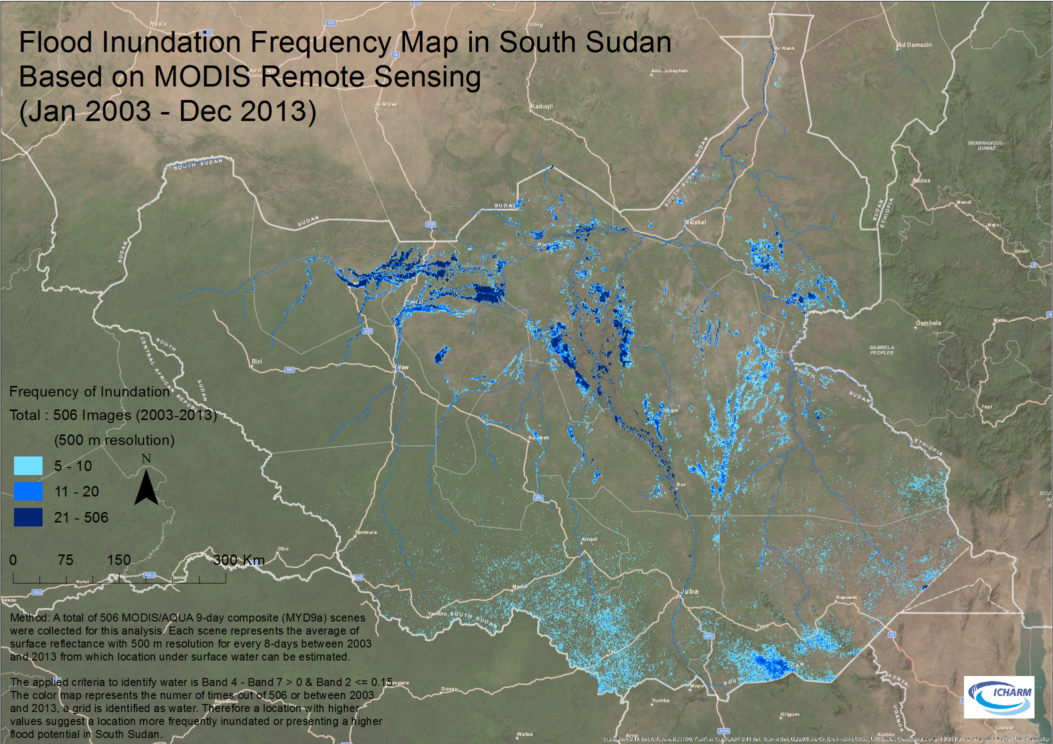
According to UNESCO office in South Sudan, a number of IDPs (Internally Displaced Persons) may currently live in high flood potential areas in South Sudan. As humanitarian and emergency aid to mitigate flood damages, a country wide flood hazard map is desired for effective evacuations. For this purpose, ICHARM rapidly analyzed a series of MODIS remote sensing images (a total of 506 images) obtained from January 2003 to December 2013.