
Prevent Traffic Accidents! An Introduction to Rumble Strips
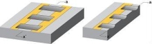 Rumble strip cross section |
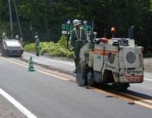 Rumble strip installation machine |
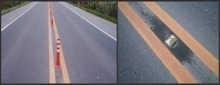 (Left) Center pole (Right) Chatter bar |
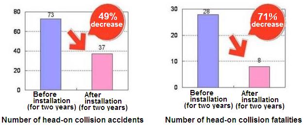 Numbers of head-on collision accidents and deaths before and after the installation |
One characteristic of traffic accidents in Hokkaido is the large number of fatal accidents compared to a total number of accidents, particularly those due to head-on collisions.
The Civil Engineering Research Institute for Cold Region (CERI) has studied low-cost, easy-to-implement countermeasures for traffic accidents that do not hamper snow removal during the winter and has developed a method of preventing head-on collisions by applying rumble strips along the center traffic line.
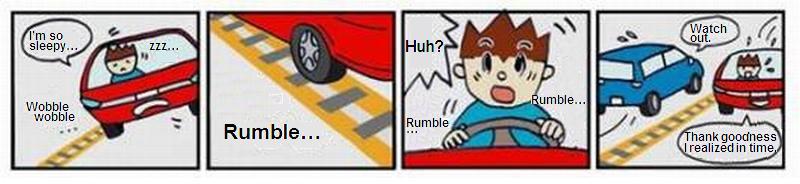
Rumble strips are a measure against run-off-the-road accidents and head-on collisions. They are rows of grooves placed on the pavement surface to warn drivers who come into contact the strips by means of noise and uncomfortable vibration.
Existing asphalt road cutters are modified to cut grooves for rumble strips while the cutter is running, allowing quick and low-cost installation. Rumble strips are concave and, unlike other countermeasures for head-on collisions using protruding items such as center poles and chatter bars, do not interfere with snow removal.
The installation of rumble strips is becoming widespread on national highways in Hokkaido and the total length of 39 routes reached 609 km as of the end of FY2006. A comparison between two years before and after the installation of rumble strips in the 60 sections where they were installed during the three years between FY2006 and FY2008 shows significant results, with the number of head-on collision accidents reduced by 49 percent and fatalities by 71 percent. Their installation is also been becoming popular as an effective countermeasure for head-collision accidents in areas outside Hokkaido where there is no accumulation of snow.
| What are rumble strips? (Click to enlarge) |
(Contact: Traffic Engineering Research Team, CERI
Go to the Rumble Strips webpage)
Report on the Flood Hazard Mapping Training Course
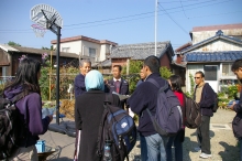 Town watching |
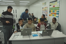 Group discussion |
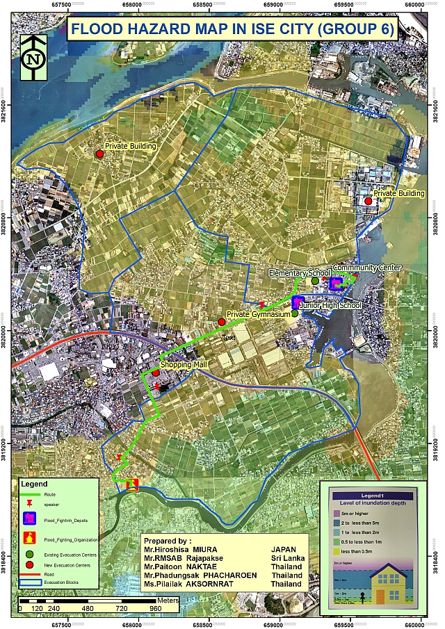 Original flood hazard map created by trainees |
From Oct. 30th to Nov. 29th, 2007, the 4th East & Southeast Asia Regional Flood Hazard Mapping training course was given at ICHARM with the cooperation of the Japan International Cooperation Agency (JICA). This course, which is intended for trainees from Indonesia, Malaysia, Cambodia, Thailand, the Philippines, Laos, China, Vietnam, and Sri Lanka (a total of 20 engineers working for public organizations in charge of flood management in their home countries), is held in order to develop human resources that have learned the technologies and Japanese know-how related to the creation and dissemination of flood hazard maps and who are engaged in operations related to the creation and dissemination of flood hazard maps in their home countries.
The course curriculum is divided mainly into lectures, exercises, field surveys, and group discussions. The overview of the curriculum is as follows.
Lectures: Learning about the current flood situation in Japan and other countries and the current status of hazard maps and technique to acquire data required to create a flood hazard map
Exercises: Runoff model such as tank models and storage function methods and inundation analyses required for the creation of flood hazard maps, computer software, and GIS exercises
Field surveys: "Town watching," in which trainees walk throughout the town with a flood hazard map and interview the residents with the cooperation of the local government, thereby recognizing hazardous locations and the effectiveness of the map
Group discussions: Summarizing the issues and discussing proposed solutions in groups after the town watching
This course focuses on exercises and field surveys. At the end of the course, the individual trainees used sample data and the results of field surveys to make flood simulations by themselves and created their own flood hazard maps. These exercises have enabled them to acquire the skills required for using flood hazard area data at home to make flood hazard maps after returning to their respective home countries. At the end of the course, an action plan on how to create and disseminate flood hazard maps at home was drawn up for each country.
(Contact: International Technical Exchange Team, ICHARM)