
Damages by The 2011 off the Pacific coast of Tohoku Earthquake Surveyed with US Bridge Experts
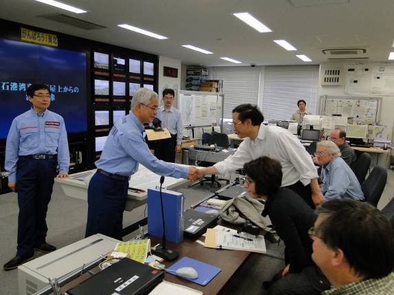
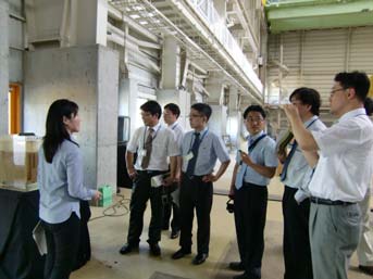
Courtesy Visit to Tohoku
Regional Development Bureau
(Director-General Tokuyama
on the left;
Dr. Philip Yen on the right)
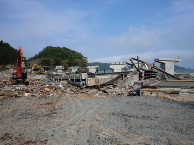
Damages of Utatsu Bridge
with displaced
girders (above) and
discussion on site (below)
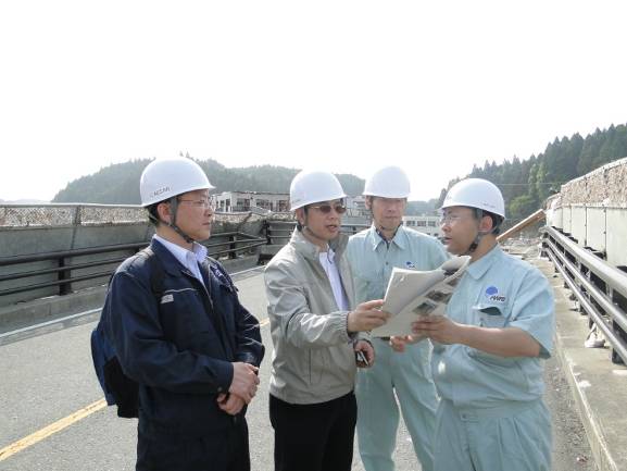
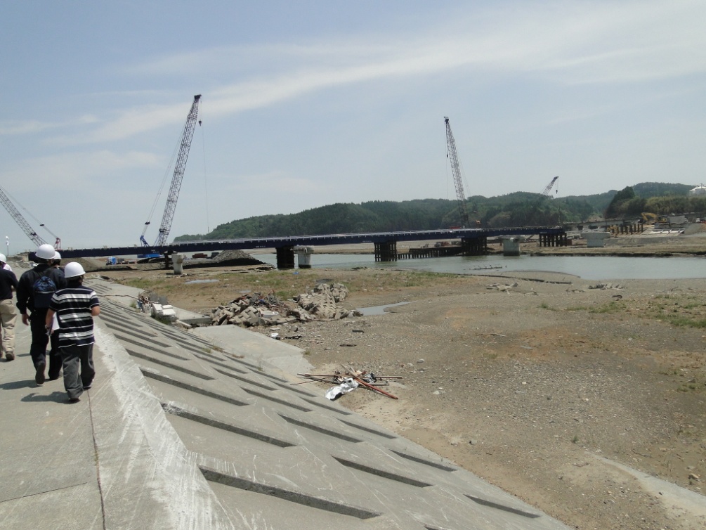
Koizumi Bridge, a damaged bridge,
with an adjacent temporary bridge
under construction.
(*The temporary bridge was
opened on Jun.26th.)
From Jun. 3rd to 6th, 2011, members mostly from CAESAR jointly surveyed bridges damaged by the Great East Japan Earthquake with six US experts on bridges and ground, including Dr. Phillip Yen, Program Manager of the Seismic Hazard Mitigation Program, Federal Highway Administration, Turner-Fairbanks Highway Research Center.
This survey was conducted as part of the activities of “Task Committee G (Transportation systems; US-side TC Chair: Dr. Phillip Yen, Federal Highway Administration; Japan-side Chair: Tetsurou Kuwabara, Director of Bridge and Structural Engineering Research Group, CAESAR)” under the Panel on Wind and Seismic Effects of the U.S.-Japan Cooperative Program in Natural Resources (UJNR).
On the first day, the surveyors visited the Tohoku Regional Development Bureau, made a courtesy visit to Director-General Hideo Tokuyama, and were given an overview of the damages and actions including emergency repairs. They then inspected a Sendai-Tohbu viaduct, where rubber bearings had ruptured, and the ruptured supports.
On the second day, they surveyed five bridges, mainly on Route 45, damaged by the tsunami. At the first visit to the Koizumi Bridge (Kesennuma city), the devastation such that the previous street appearance could not even be imagined shocked them . They paid silent tribute to the many victims and then surveyed damages to the girders and piers of the ruined bridge and dampers for reducing vibration of the girders. They also surveyed the Utatsu Bridge (Minami Sanriku-cho) where the girders had been washed away and Nijyuichihama Bridges where backfill soil for abutment had been washed out. Various regions in the U.S. such as Hawaii and Alaska are at risk from a large tsunami as well. Therefore, they were interested in the mechanisms of washout of bridge piers when they witnessed the devastated sites where bridges and houses had disappeared under the awesome force of the tsunami.
On the third day, they investigated two seismic retrofit bridges in Sendai city (damaged by the 1978 Miyagi earthquake), and two bridges in and around Oshu city, Iwate Prefecture , and discussed reviews on the effects of seismic retrofit measures and causes of damages.
On the last day, they surveyed damages to the Arakawa Wangan Bridge of the Metropolitan Expressway, which is a cantilevered truss bridge, and changes in ground and structures owing to liquefaction in the Urayasu area.
The results of the four-day survey will be summarized and reported at the UJNR Joint Panel meeting held in August and next Bridge Workshop held in November.
Finally, we pray once again for the souls of all those who lost their lives, extend our deepest sympathies to the sufferers, and hope the region will be restored as soon as possible.
Special thanks are due to Tohoku Regional Development Bureau, East Nippon Expressway Co., Ltd., and Metropolitan Expressway Co., Ltd. for their consideration and assistance with the surveys.
(Contact: CAESAR)
The Scent of Cherry Blossoms: Public Viewing of CERI’s Chishima Cherry Trees
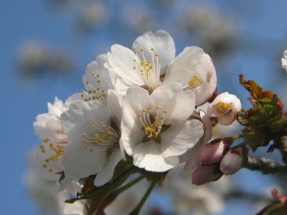
Chishima cherry blossoms
a symbol of undiscovered potential
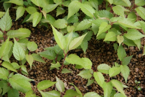
Seedlings cultivated from seeds
collected last year
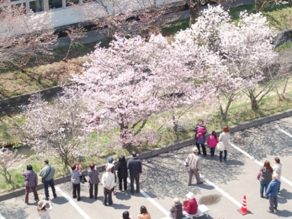
Visitors enjoy viewing
the Chishima cherry blossoms
Since 1999, the Civil Engineering Research Institute for Cold Region has opened its premises to the public during the best season to allow viewing of approximately 200 Chishima cherry trees, which bloom a little earlier than the Somei Yoshino cherry trees in Sapporo.
This year again, more than 12,000 people visited the institute despite rainy weather during the ten-day period from May 2nd to 11th due to the event’s promotion in newspapers and on TV.
The Chishima cherry tree grows wild mainly on the Chishima Islands (as indicated by its name), on Sakhalin Island, in the eastern and northern parts of Hokkaido, and up to the subalpine zone north of the Chubu Region of Honshu (Japan’s main island). Unlike other cherry tree species, it is characterized by a low tree height, with branches generally spreading out from its base. The Chishima cherry tree varies widely in blossom color and form from one tree to another, giving the species a strong sense of individuality. Indeed, each Chishima cherry tree on the premises of the institute is unique, varying in size and blossom color.
According to a researcher from the Forestry Research Institute in the Forest Research Department of the Local Independent Administrative Agency Hokkaido Research Organization, another distinguishing feature of the Chishima blossom is its scent. Although cherry blossoms are generally considered to be scentless, when you put your face up to Chishima cherry blossoms, they have a soft, pleasant smell. As full-scale research on the scent of this species has just begun, further clarification is expected in the future.
In addition, a new attempt to cultivate cherry seedlings from collected seeds was started last year. Growing cherry trees from seeds requires a great deal of care in terms of temperature control and other conditions. After a year of continuous care, small shoots began to appear in spring.
The staff of the institute, with its rows of Chishima cherry trees, look forward to welcoming visitors for years to come.
(Contact: Planning Division, CERI)
Next-Generation Sludge Incinerator, Turbocherged Fluidized Bed Incineration System, Practically Implemented
-new incinerator that saves energy and reduces greenhouse gas emissions-
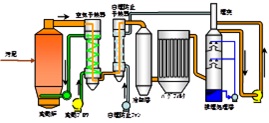
Conventional System
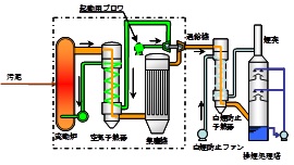
Turbocherged Fluid Incineration System
A pressurized fluid incinerator is used
as a combustion furnace. This is followed
by a turbocharger, thus eliminating the need
for a fluid blower and a suction fan,
which require electricity.
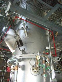
View of Main Body of
Demonstration Incinerator
(in the WWTP in
Oshamanbe-cho, Hokkaido)
A turbocherged fluidized bed incineration system, which is a next-generation sludge incinerator jointly developed by PWRI, the National Institute of Advanced Industrial Science and Technology, Tsukishima Kikai Co., Ltd. (TSK) and Sanki Engineering Co., Ltd., has been installed at sewage incineration facilities.
Characteristics of the Turbocherged Fluidized Bed Incineration System
This system is configured by combining a conventional sludge fluidized bed incinerator and a general-purpose turbocharger. Sludge is combusted under pressure, so the main body of the incinerator is compact. Exhaust gas produced during combustion drives the turbocharger, and the resulting compressed air is used for combustion. This eliminates the need for the conventional forced draft fan and induced draft fan, and thus reduces power consumption by 40%. Further, a high-temperature region is formed in the incinerator under pressurized combustion, which halves the emission of dinitrous monoxide (N2O), a greenhouse gas, compared with a conventional high-temperature incineration (850℃). This incineration system will help mitigate global warming.
Social Background of Development
Domestic production of sludge has been increasing year by year. Most of it is disposed of by incineration, but this requires a large amount of fossil fuel (heavy oil, manufactured gas, and electricity). Measures are therefore needed for reducing the energy consumed in the incineration process as well as greenhouse gases.
A demonstration plant with a scale of five tons per day was constructed in a wastewater treatment plant (WWTP) in Oshamanbe-cho, Hokkaido, and has achieved stable operation for over 2,000 hours.
Construction of this system ordered by the Bureau of Sewerage of the Tokyo Metropolitan Government (TMG) was received by TSK in February 2011. Facilities with a scale of 300 tons per day are scheduled to be completed in the Kasai Water Reclamation Center, TMG, by the end of fiscal 2013.
(Contact: Recycling Research Team)
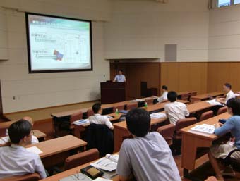
The 6th Japan-Korea Construction Technology Workshop
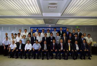
Attendees at Plenary Session
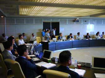
Plenary Session
Tour for facilities in PWRI
Separate session for each research field
PWRI and the Korea Institute of Construction Technology (KICT) have completed a joint research program and held the 6th Japan-Korea Construction Technology Workshop from Jun. 28th to Jul. 1st, 2011. The first workshop was held in April 2000, eleven years ago. Initially, the workshop focused on the specific joint research themes of Concrete Structure and Slope Management. Then, at the third workshop in November 2002, the four fields of Road Pavement, River Restoration, Hydrologic Monitoring and Water Purifying Monitoring were added. At the present workshop, Maintenance of Bridge, Soil Contamination and Intelligent Construction were added as new subjects, and information and views were exchanged on nine fields. This workshop had been suspended, but the two research institutes, representing their respective countries, have exchanged information and researchers.
At the workshop this time, a plenary session was held in the morning of Jun. 28th on the 8th floor of PWRI’s annex, then a tour of PWRI’s facilities was held in the afternoon, followed by the separate session for each research field.
The general meeting started with opening remarks by Dr. Taketo Uomoto, Chief Executive of PWRI, and Dr. Bae, Acting President of KICT, and subsequently Dr. Ooishi, Deputy Chief Executive, presented "Survey report of infrastructure damages caused by the Great East Japan Earthquake"; Dr. Lee, Executive Director of the International Cooperation and Information Service Department, presented "Overview on researches of KICT", and Mr. Noguchi, Executive Director for Research Coordination, presented "Overview on researches of PWRI in the third mid-term plan".
The PWRI tour included four facilities: the dam hydraulics laboratory, the large-scale universal test machine for structural components, the three-dimensional large-scale shaking table, and the large-scale dynamic centrifugal loading machine. At the separate session for each research field in the afternoon, views were exchanged and discussions held on nine fields at seven separate sites.
From Jun. 29th to Jul. 1st, technical tours were conducted in these fields, including a surface earthquake fault and a landslide site in Fukushima Prefecture, the Ohmi Bridge in Shiga Prefecture, an asphalt mixture plant, the Kushiro River in Hokkaido Prefecture Restoration Project, the upper reaches of the Tone River, and dams in Saitama Prefecture. Views were actively exchanged not only at the separate session for each research field meetings but also through the technical tours.
In the afternoon of Jun. 29th, executives of PWRI and KICT made arrangements for the next workshop. They agreed that the seventh workshop will be held in Korea next year, and that they will judge whether to formally include the three fields newly discussed this time (Maintenance of Bridge, Soil Contamination and Intelligent Construction) in the Joint research program between PWRI and KICT based on the discussions in this workshop.
(Contact: River Restoration Research Team)
Progress on ADB-ICHARM jointly Technical Assistance Activities in Asia
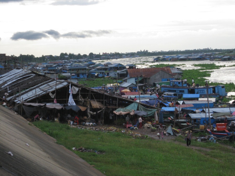
People living on the water
in Kampong Chhnang lead a hard life
(click the image to enlarge)
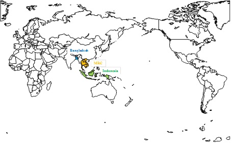
International Centre for Water Hazard and Risk Management (ICHARM) is now conducting ADB-funded technical assistance projects in Bangladesh, Indonesia and the Lower Mekong Basin (LMB).
This article reports on a recent development of the project in LMB.
The main objective of the LMB project is to formulate the Flood Vulnerability Index (FVI), considering the both physical component (PhC) which related to flood and topography and socio-economic component (SoC) which related to livelihood and poverty condition.
For PhC, ICHARM proposed the “ICHARM Hydro-Geo Method (IHGM)” and made a trial application to a Cambodian floodplain. The key concept of IHGM is to reproduce the micro-topographical effects, since the Cambodian floodplain is very flat and the undulation of the land is considered as an important physical condision.
In April 2011, ICHARM sent Shigenobu Tanaka, deputy director, and Katsuhito Miyake, chief researcher, to Cambodia to explain about the proposed IHGM to the Mekong River Commission Secretariat, which was well received.
In June 2011, an ICHARM team led by Miyake with Youngjoo Kwak and Shigenobu Hibino, both research specialists, visited the Cambodia target area and confirm the validity of the assumptions made to develop PhC.
Also in June 2011, a socio-economic household survey to calculate SoC of FVI was conducted in Kampong Thom, Kandal and Pray Veng provinces. A total of 480 households and 48villages were surveyed successfully. This socio-economic survey were conducted by an international consultant contracted by ADB.
The total FVI will be finally estimated by combining PhC and SoC.
The FVI is expected as an index which shows a necessary investment and duration to prevent water related hazard to foreign governments.
1) ADB (Asian Development Bank) was established in 1966 by Asia and Pacific countries. The numbers of the member countries are 67 including 48 Asia and Pacific countries. ADB is managed by the investment from member countries and Japan contributes to investment next to United States of America.
For more detail information, please refer to the following URL;
http://www.adb.org/
2)The Mekong River Commission
The Mekong River Commission (MRC) was formed in 1995 by an agreement between the governments of Cambodia, Lao PDR, Thailand and Viet Nam. The four countries signed The Agreement on the Cooperation for the Sustainable Development of the Mekong River Basin and agreed on joint management of their shared water resources and development of the economic potential of the river.
For more detail information, please refer to the following URL;
http://www.mrcmekong.org
(Contact: ICHARM)
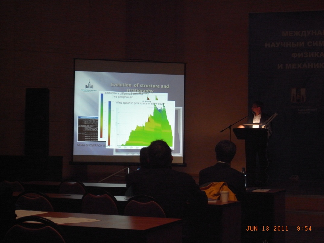
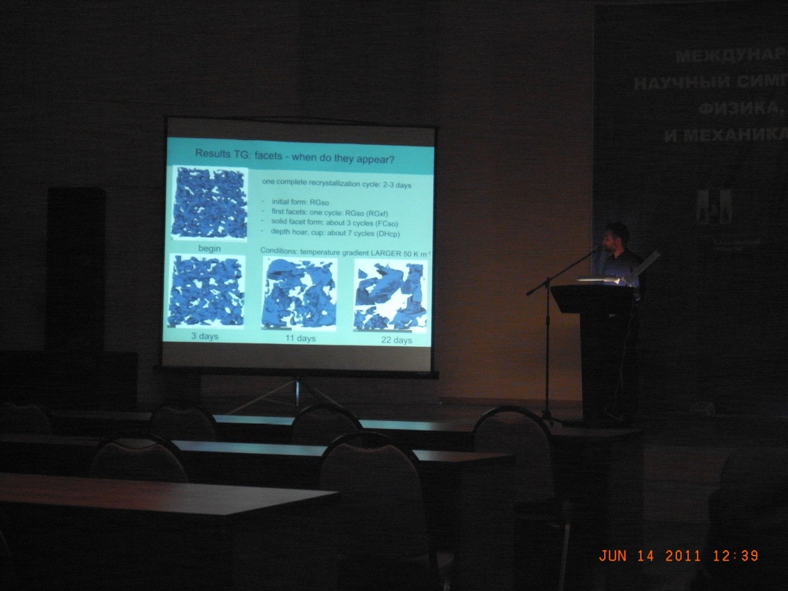
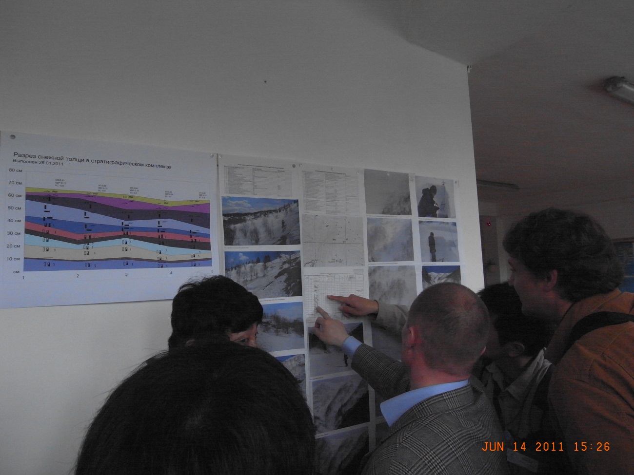
International Symposium "Physics, Chemistry and Mechanics of Snow"
Keynote Lecture by Dr. Sergey
Presentation of research results
on snow metamorphism based
on X-ray observations
by Dr. Schneebeli,
Institute for Snow and Avalanche
Research, Switzerland
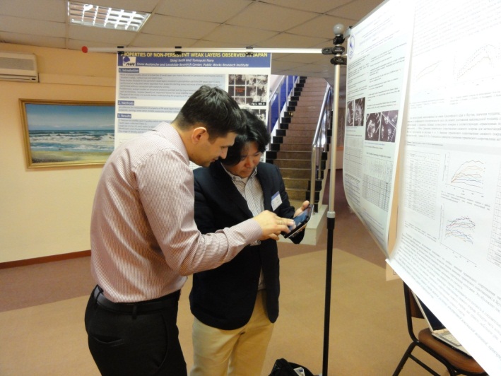
Discussion in Poster Session
Visiting the Far East Branch
of the Russian Academy Sciences
(Illustration of an avalanche in Sakhalin)
The International Symposium “Physics, Chemistry and Mechanics of Snow” was held in Yuzhno-Sakhalinsk in the Russian Federation from Jun. 13th to 16th. Three researchers of PWRI, Dr. Ito and Dr. Ikeda of the Snow Avalanche and Landslide Research Center, and Dr. Matsushita of the Snow and Ice Research Team, attended the symposium, which is outlined below.
The symposium was hosted by the International Glaciological Society, which is the sole international academic society pertaining to snow and ice, with the cooperation of the Far East Geological Institute of the Far East Branch of the Russian Academy Sciences, and the regional government of Sakhalin Oblast in the Russian Federation. This symposium provides a forum for researchers on snow and ice from various countries. Accordingly, the researchers can widely promote their studies, and grasp the state of cutting-edge research in various countries in related fields.
The aim of the symposium is to assess the results of fundamental research, such as the physics, chemistry and mechanics of snow, covering all types of snow and ice phenomena as well as snow and ice disasters, such as snow avalanches, and to discuss future prospects.
About forty people participated in the symposium from five countries; 43 presentations were delivered including oral and poster presentations.
At the beginning, keynote lectures were given by Dr. Sergey of the Scientific Research Laboratory of Snow Avalanches and Debris Flows, Moscow State University, and Dr. Maeno, Emeritus Professor of Hokkaido University. The lecture by Dr. Maeno under the title of "Non-traditional applications of snow physics, ice friction, snow avalanches, singing snow and curling," illustrated familiar snow and ice phenomena such as singing snow and curling based on fundamental snow and ice physics. This lecture was unique and interesting, and showed once again the importance of fundamental research for understanding phenomena.
The key research presentation this time was research results using new observation techniques on the micro structure of snowpack using MRI and X-ray. These observation techniques have great potential for various fields of fundamental research, such as on the metamorphism and fracture mechanics of snowpack, and also for applied research such as avalanche prevention. The techniques are certainly worth following in future.
From PWRI, Dr. Ito and Dr. Ikeda of the Snow Avalanche and Landslide Research
Center presented "Research results on temporal variation in strength
after accumulated snow includes water" and "Research results
on properties of a snow crystal weak layer", respectively; Matsushita
of the Snow and Ice Research Team of the Civil Engineering Research Institute
for Cold Regions presented "Research results on temporal variation
in shear strength of fresh snow." For details of the symposium, please
refer to http://snowphysics.fegi.ru/en/main.html.
(Contact: Snow Avalanche and Landslide Research Center)
An example of effect on seawalls and Other Tsunami Protection Facilities (Hamanaka Town, Hokkaido)
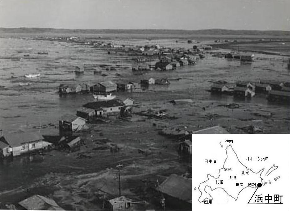
Tsunami damage caused
by the 1960 Valdivia earthquake
(Photo courtesy of Hamanaka Town Office)
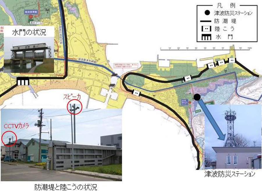
Seawalls and other facilities of Hamanaka Town
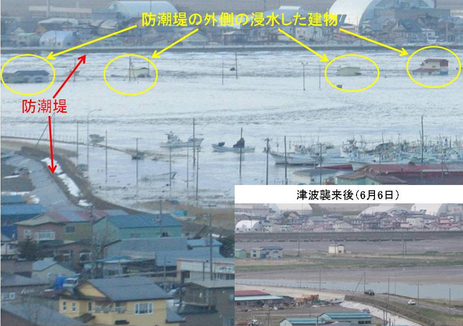
The town when the tsunami hit
(16:30, Mar. 11th)
(Photo courtesy of Hamanaka Town Office)
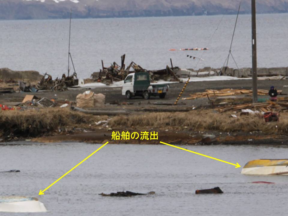
The area outside the seawall
after the tsunami (Mar. 15th)
1.Introduction
Hokkaido has previously suffered enormous damage from tsunamis caused by major earthquakes, such as the 1952 Tokachi-Oki earthquake, the 1960 Valdivia earthquake, and the 1993 Hokkaido-Nansei-Oki earthquake, to name just a few that have struck since the end of World War II. Against this background, tsunami protection facilities were constructed in the towns of Okushiri and Setana, which were damaged by the Hokkaido-Nansei-Oki earthquake, and in the town of Hamanaka, which was damaged by the Tokachi-Oki earthquake and the Valdivia earthquake. Since a number of coastal dikes and tsunami protection breakwaters were destroyed along the Pacific coast in the Tohoku region by the Great East Japan Earthquake in March 2011, it has been pointed out that the effectiveness of structural measures, such as building coastal protection facilities, has limitations. However, structural measures should be combined with non-structural measures, such as emergency drills, as a matter of course. From this perspective, Hamanaka Town is introduced as an example of a place with seawalls and other facilities that appropriately served their purpose of protecting the urban area from flooding. After the earthquake, the Eastern Hokkaido Branch Office and the Port and Coast Research Team of the Civil Engineering Research Institute for Cold Region conducted field surveys along the Pacific coast in the eastern part of Hokkaido. This report is based on the results of these surveys in the town and interviews with the staff of the town office.
2.Overview of the seawalls and other facilities
In view of the area’s history of repeated tsunami damage, seawalls measuring
18 km in total length and 3 m in height (elevation: 5.3 m), four tide gates
and five land locks* were constructed. Hokkaido’s only tsunami safety station1) was built there in 2001, enabling remote opening and closing of the tide
gates and land locks.
3.Effects of the seawalls and other facilities
The Japan Meteorological Agency announced2) that the first tsunami wave (backwash) reached the town of Hamanaka at 15:27 on Mar. 11th, and a tsunami with a maximum wave height of 2.6 m (tidal level: 3.42 m) was observed by a tide gauge near one of the tide gates at 22: 19 the same day. CCTV cameras in the vicinity of the land locks recorded tsunamis reaching almost the height of the seawall. The tsunami height when the photo shown here was taken (at 16:30 from higher ground in the town) was 2.0 m according to the Japan Meteorological Agency. It can be seen from the photo that the urban areas protected by the seawalls were saved from flooding, whereas buildings outside the walls were flooded and boats there were swept away.
4.Conclusion
The construction of seawalls and other facilities is significant, as it
represents structural measures for protecting life and property from tsunamis
and high tides up to the height set in the relevant disaster prevention
plan. Hamanaka Town also restricts the construction of residential buildings
outside the seawalls, distributes tsunami hazard maps to every household,
improves evacuation routes, conducts emergency drills, organizes workshops
for elementary, junior high and high school students, and performs other
activities as non-structural measures. The town’s efforts in this regard
produced the third-highest evacuation rate among Hokkaido municipalities
upon the occurrence of the March 2011 earthquake3). The authors would like to express their appreciation to Hamanaka Town
Office for the provision of data used in this report.
5.References (Japanese)
1)Ministry of Land, Infrastructure, Transport and Tourism website: Hokkaido Hamanaka Town Tsunami Disaster Prevention Station
http://www.mlit.go.jp/river/pamphlet_jirei/kaigan/gaiyou/panf/station/hokkai.pdf
2) Japan Meteorological Agency website: Weather, Climate & Earthquake
Information
http://www.jma.go.jp/jp/tsunami/observation_04_20110313180559.html#text
3) Crisis Management Division, Bureau of Crisis Management, Department
of General Affairs, Hokkaido Government (2011): Number of evacuees confirmed
at evacuation centers and other locations by municipality (as of Mar. 15th,
2011)
* Land locks: gates allowing pedestrians and vehicles to access facilities located on the sea-side of embankments
(Contact: Eastern Hokkaido Branch Office, Cold-Region Technology Promotion Division, CERI)