
The Development of a Winter Road Surface Improvement Simulator (WiRIS)
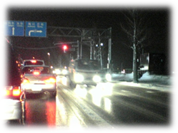
Very slippery snow/
ice-covered surface
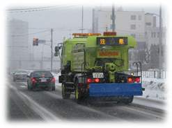
A service vehicle spreads
anti-icing agent

WiRIS input/output display
(click to enlarge)
Background
Weather and road surface conditions in winter are very complex; therefore, appropriate road management is not easy. For example, it is uncertain how effective it is to apply 20 g of anti-icing agent per square meter on compacted-snow road surfaces when the air temperature is -3℃. In addition, in many cases, the effectiveness of anti-icing agent is unclear when any factor is changed. For example, if the air temperature is -8℃or if the application rate is 30 g per square meter, it is not certain how its effectiveness degrades or improves.
The problem with the application of anti-icing agent is that there has been no way of estimating the conditions of ice and snow on roads and the coefficient of sliding friction (μ) on roads. Therefore, assessing effectiveness was impossible. To address the problem, the Traffic Engineering Research Team developed a method for estimating the μ on roads that have been spread with anti-icing agent. (This method is called "the friction estimation method".) The estimation is done by using weather, traffic, road surface conditions, and pavement type as parameters.
Simulation of the effectiveness of anti-icing agent
Based on the friction estimation method, we developed a software application that simulates winter road surface improvement. It is called the Winter Road Surface Improvement Simulator (WiRIS). When the road surface conditions, traffic conditions, weather conditions, and other parameters are input, WiRIS estimates μ for roads that have been treated with anti-icing agent. In addition, WiRIS determines whether anti-icing agent needs to be applied, recommends an application rate if the agent is required, and proposes an alternate solution if the application of anti-icing agent is inappropriate. In reality, because there are many restrictions on road management, it is difficult to carry out all of the measures that are output by WiRIS. Even so, it is important to take possible measures with an understanding of the appropriate measures from WiRIS. While letting road administrators use WiRIS, we will make improvements in it and we will examine more effective use.
(Contac: Traffic Engineering Research Team, Civil Engineering Research Institute for Cold Region)
Development of a technique for designing attractive pedestrian spaces

Figure–1 Example of tests for
evaluating impressions
(click to enlarge)

Figure–2 Example of the analysis results
(click to enlarge)
Background and aim of our study
Recently, improve the attractiveness of regions and districts is a key issue in light of the need to vitalize such local communities. To address this issue, maintaining attractive landscapes in those communities that include civil engineering infrastructures such as towns and streets is highly important; however, technical support for this objective is still insufficient.
To contribute to the solution of this problem, we have engaged in research on improved techniques for designing pedestrian spaces, such as streets, sidewalks and other open spaces.
Outline of our study
We showed photographs of variety of pedestrian spaces to many individuals and asked their preferences for these spaces. This shall give us statistical data that will help us understand what kinds of pedestrian spaces are preferred. Further, if we show series of composite photographs, i.e., partly altered (patched) photographs, and ask individuals about their preferences, we can identify the elements of pedestrian spaces that affect their preferences. In addition, if we ask individuals about their impressions as well as their preferences, we can use statistical methods (e.g., regression analysis and factor analysis using semantic differential data) to investigate the reasons for those preferences.
Based on the above assumption, we conducted “impression tests” with the photographs of the pedestrian spaces and the participation of subjects. In the tests, we showed many photographs with multiple variations; some photos were created by altering a portion of each pedestrian spaces (Figure–1). Using the results of these tests, we performed an analysis to understand the requirements for attractive pedestrian spaces (Figure–2).
From the analysis, we found 3 keywords (impressions) for the pedestrian spaces tend to be evaluated as being attractive; they are “natural”, “open”, and “embraced”. In other words, it was found that maintain pedestrian spaces to lessen people's “artificial”, “exposed”, and “confining” impressions will lead to attractive pedestrian spaces.
The findings suggests that, for example, a walking path in woods that gives the impression “natural” together with “embraced” may be attractive enough in many case, but will be more attractive if cleared underbrush and lower branches to secure good visibility as to create the impression that the path is “open”. Another example will be a downtown area where some adverse landscape elements were removed, such as by relocating overhead power lines underground. Because such measures only contribute to giving the impression that the landscape is “open”, other measures lessening the impressions that the landscape is “artificial” and “exposed” should be considered, in order to satisfactorily improve the attractiveness of the landscape.
Before our study, it has not been clarified what should be done to enhance the attractiveness of pedestrian spaces, because landscape evaluation criteria for pedestrian spaces have not been fully examined.
This study is expected to provide a framework for evaluating the ways of efficiently improving the attractiveness of pedestrian spaces. We are planning to disseminate our results by publishing a design manual or the like near the future.
(Contact:Scenic Landscape Research Unit, Civil Engineering Research Institute for Cold Region)