Development of an App to Help Snowplow Operators Locate Road Accessories
To avoid damage to road accessories such as bridge joints and manholes during snow removal operations (Figure-1), it is necessary to move the blade of the snow removal vehicle away from the road accessory, whose location is hard to determine because such accessories are often buried under snow. Technique and experience enable skilled operators to avoid problem spots; however, such operators have been aging and retiring.
Figure-1 Snow removal in progress
Snow removal operations on national highways are typically carried out by two-person crews consisting of an operator and an assistant. However, as the number of workers is expected to decrease, the single-person operation of snow removal vehicles will be required (Figure-2). In single-person operation, the operator must perform all of the safety checks around the vehicle that had mainly been performed by the assistant. This may distract the operator from avoiding road accessories, or it might cause the operator to pay excessive attention to road accessories and to neglect the safety checks around the vehicle.

|

|
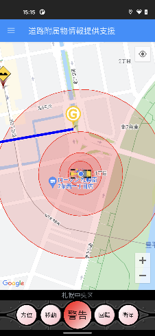
To solve the above problems, we have developed a smartphone app called Road Accessory Locator (hereinafter, “the app”). The app provides voice guidance on the locations of manholes, bridge joints, and other road accessories as a low-cost, easy-to-install support technology for snowplow operators (Figure-3).

|

|

|

|
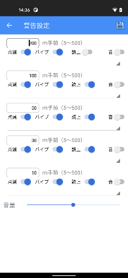
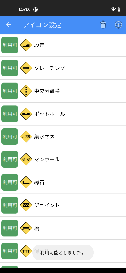
The Android app (Ver. 7.0 or later) is unavailable in app stores It is provided free of charge to anyone who contacts us. The app screen displays a map with the locations of registered road accessories. Pressing the “WARNING” button launches the app. The current position of the snow removal vehicle is displayed at the center of red concentric circles that show the set warning distance to the road accessory. When the distance between the snow removal vehicle and the road accessory reaches the set value, the smartphone sends out an alert. Alerts can be selected from “screen lighting”, “vibration”, “text readout”, and “alert sound”. Up to five different alert warning patterns can be set, depending on the distance between the snow removal vehicle and the road accessory. The app can be used immediately after installation, but it requires that the target road accessories be registered. The menu for selecting road accessories includes such as steps but it is possible to set any object to be avoided and to change the icon to the photo of one’s choice.
(Contact : Machinery Technology Research Team, CERI)
Research on Projections for Future Water Resources in Light of Climate Change
1. Background of the study
The weather is predicted to change dramatically with climate change. Flood control planning reflects the effects of climate change. For example, in Hokkaido, the river discharge values that are used for formulating flood countermeasures have been revised based on the assumption that the rainfall change multiplier will be 1.15 times the current value with 2°C higher air temperature. Water utilization is also expected to be affected by climate change, and techniques are needed to estimate the degree to which climate change will affect such utilization.
Against this background, the Watershed Environmental Engineering Research Team is conducting research on projecting future water resources in light of climate change. Specifically, we are conducting numerical simulations and field observations on changes in river discharge (especially during droughts) and in river water temperature, and the effects of these changes on organisms given climate change. Here we introduce some of the results regarding future changes with respect to snow.
2. Predicting the impacts of climate change on snow conditions
Snow cover (Figure-1) is an important source of water in snowy and cold regions, and it is important to predict how global warming will affect snow cover and snowmelt. Climate change projections are made using numerical calculations called ensemble experiments. An ensemble experiment is one in which multiple calculations are performed with slight variations in the initial values and boundary conditions, for example, in the sea surface temperature. The probability circle shown in the projection of a typhoon’s path is one example of the use of an ensemble forecast done several days ahead of the issuance of a projection. This method makes it possible to estimate the frequency of extreme weather events. Data sets that cover thousands of years of climatic conditions from past to future and that are able to be used in calculating past and future weather-related values are publicly available.
We used these data sets to predict future changes in snow depth in Hokkaido. The peak snow depth in March, the month in which the snow depth peaks in most regions of Hokkaido, especially on the Sea of Japan side, was predicted to be less under a future climate with 4°C higher air temperature than under the present climate (Figure-2).。
As another example, we predicted changes in the water equivalent of snow cover (the amount of water converted from snow cover) in the catchment area of Jozankei Dam, which is at the upper reaches of the Toyohira River, a river that flows through Sapporo City. The future water equivalent of snow cover was determined to be about two-thirds of the peak amount under the present climate (from previous experiments), and the predicted timing of snow disappearance was about one month earlier under a future climate with 4°C higher air temperature (Figure-3).
3. Future research plans
he ensemble experiments show that snow cover tends to decrease and the snow-melting season tends to shift earlier in Hokkaido. Dams on the Toyohira River, for example, are expected to have less stored water and to see earlier snowmelt floods, which may affect the water intake for municipal water supply and the spawning and habitats of cherry salmon and other salmon.
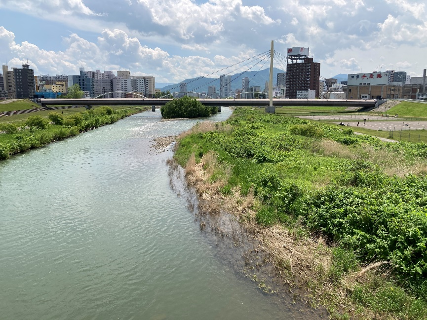
In future studies, we will work on forecasting the amount and temperature of water flowing from the mountains into these dams and into rivers below these dams and on assessing the risks associated with those changes for fishes and other organisms. In preparation for future research, we are conducting snow cover surveys, river water temperature surveys, and surveys of run and roe bed environments for cherry salmon and other salmon, mainly in the Toyohira River basin (Figure-4).

Figure-4 Toyohira River
(Contact : Watershed Environmental Engineering Research Team, CERI)


