
Natural dam emerged at Kii Peninsula due to Typhoon Talas in 2011
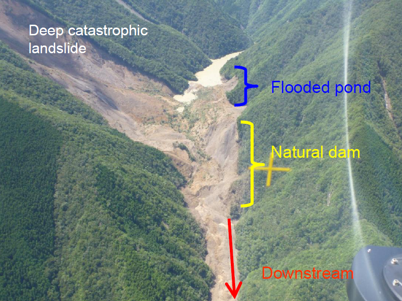
Photo 1: River channel blockages emerging in Akadani District due to Typhoon Talas. (Photographed on Sep. 6th, 2011.)
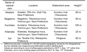
Table 1: Five natural dams under emergency survey according to the Sediment Disasters Prevention Act
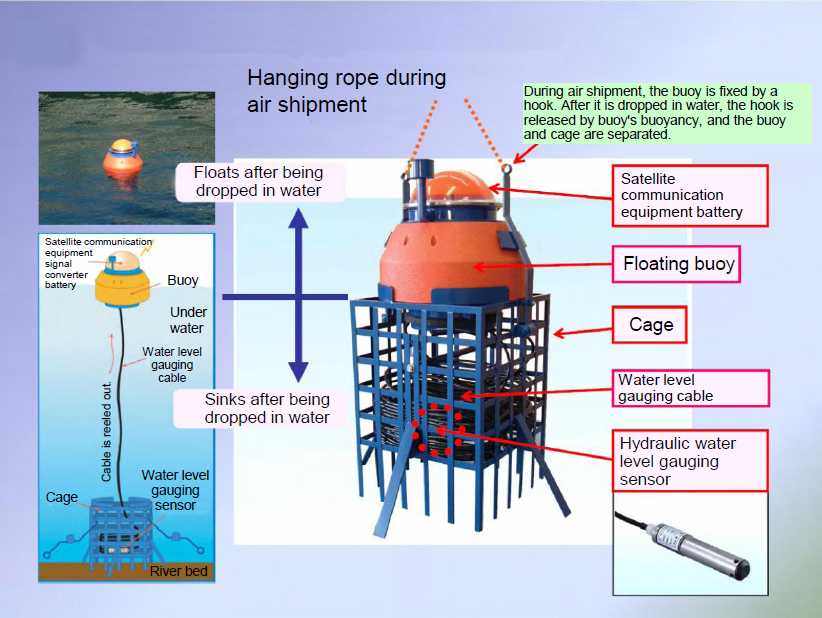
Figure 1: Structure of PWRI’s aerially-placable water stage gauging buoy
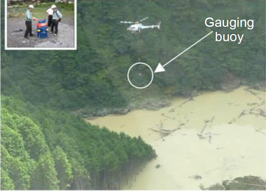
Figure 1: Installation of the gauging buoy by a hlicopter
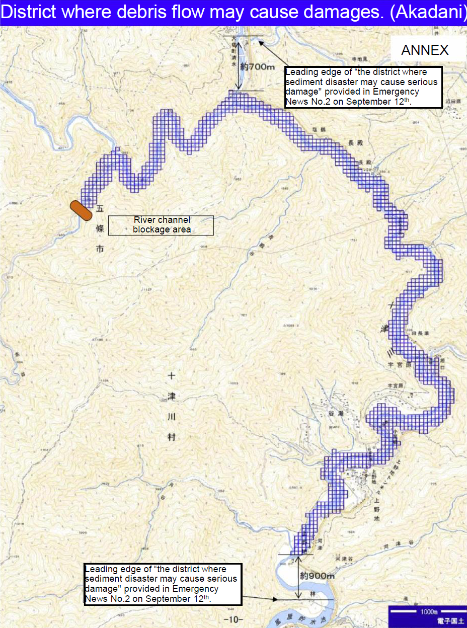
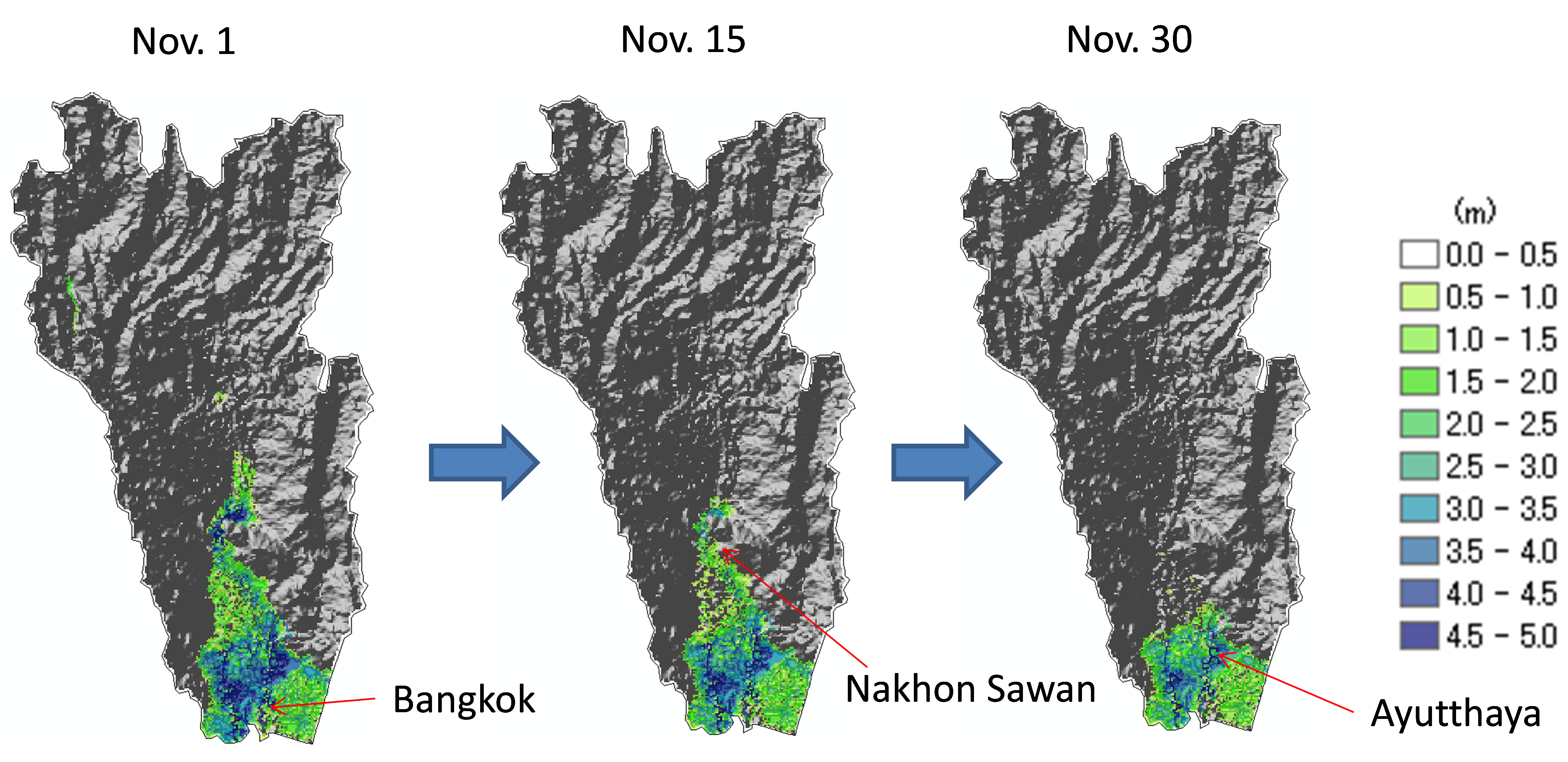
Figure 2: Estimated area of damage due to debris flow caused by overflow and erosion of natural dam (Quoted from news briefing paper published by Kinki Regional Development Bureau in Nov. 2nd.)
Introduction
Due to Typhoon Talas, which hit from Sep. 2nd through 4th 2011, total precipitation reached 1,000 mm or more in the Kii Peninsula Mountains. There were multiple cases of mountain side collapse, debris flow, deep catastrophic landslides, and river channel lock out (which, by law, is called a “landslide dam” by news reports, although it is scientifically referred to as a “natural dam”), and 39 people died from this disaster. Furthermore, as a potential disaster, there was the fear that if water overflowed from a dammed-up pond upstream, then the natural dam would be eroded, and then large-scale debris flow (a natural phenomena in which debris flows as one with water) in a downriver direction could occur. If such a disaster occurred, it could cause tremendous damages. To respond to this, immediately after the typhoon passed, the Kinki Regional Development Bureau of MLIT, hereinafter called KRDB, investigated areas spanning the Kii Peninsula using helicopters and artificial satellites. As a result, we found that roadless mountainous areas formed five large-scalenatural dams (for a typical example, see Photo 1), and then we started a full-fledged investigation on Sep. 6th (see Table 1). In this Web magazine, you will learn of the actions that PWRI undertook collaboratively with the KRDB, including 1) Installation of devices to monitor timing when water overflows from ponds flooded bynatural dams, and 2) Estimation of coverage when debris flow overflows in the case of water overflow from upstream ponds flooded by natural dams.
Installation of devices to monitor timing when water overflows from ponds flooded by natural dams
To estimate the time until overflow, it is essential for us to get information including the time-series behavior of water levels at natural dams where there are dammed-up ponds upstream. Since the natural dams in Table 1 occurred in mountainous areas, access via land routes was difficult and there were no data transmission facilities. To overcome this, we installed Aerially Placable Floating Water Stage Gauge (APF gauge in Figure 1), which was developed to observe the water level of ponds flooded by natural dams under such circumstances. We installed them in Akadani District on Sep. 8th, four days after the typhoon passed, and in Nagatono, Kuridaira, and Iya Districts on Sep. 9th. Water level data was published by the KRDB on their web page every hour (see news briefing papers published from September to November at http://www.kkr.mlit.go.jp).
Estimation of damaged area where debris flow overflows in the case of water overflow from a dammed-up pond upstream of a natural dam
Although it is obvious that natural dams occur due to earthquakes or heavy rain, it is hard to proactively predict the location and extent of the dams that will be formed. Therefore, we cannot predict the extent to which debris flow will spread after overflow until we investigate the actual natural dam. Knowing this extent is useful in having residents evacuate. PWRI has organized necessary investigation methods and developed programs to predict the extent to which debris flow will spread. The KRDB, working collaboratively with PWRI, predicted the extent to which debris flow may cause damage. Since the investigation continued as time passed, once the investigation reached a certain stage, the extent was revised. We published these predictions with different timing depending on the district. To use Akadani District as an example, the first prediction was published on Sep. 8th, the first revision was on Sep. 12th, and the second revision was on Nov. 2nd (Figure 2).
Conclusion
The investigation methods and prediction methods specified in this section were developed based on experience and knowledge obtained through investigation of natural dams that occurred in The Mid Niigata prefecture Earthquake in 2004 and The Iwate-Miyagi Nairiku Earthquake in 2008. However, because natural dams rarely occur, we have few scientifically accurate records and many uncertain points. PWRI is now in the process of collecting and organizing natural dam data generated by Typhoon Talas, as well as performing review of the successful and unsuccessful points of using this method. Looking forward, we hope that this experience can help reduce future damages.
In addition, the response of KRDB or PWRI to this natural dam specified in this section is the first example in Japan where the method of responding to natural dams regulated in the May 2011 “Law for Partial Amendment to Act on Sediment Disaster Countermeasures for Sediment Disaster Prone Areas” (Commonly known as “Sediment Disaster Prevention Act”) was carried out.
(Contact:Volcano and Debris Flow Research Team)
One day session was organized by PWRI / ICHARM with ADB in ADB water learning week
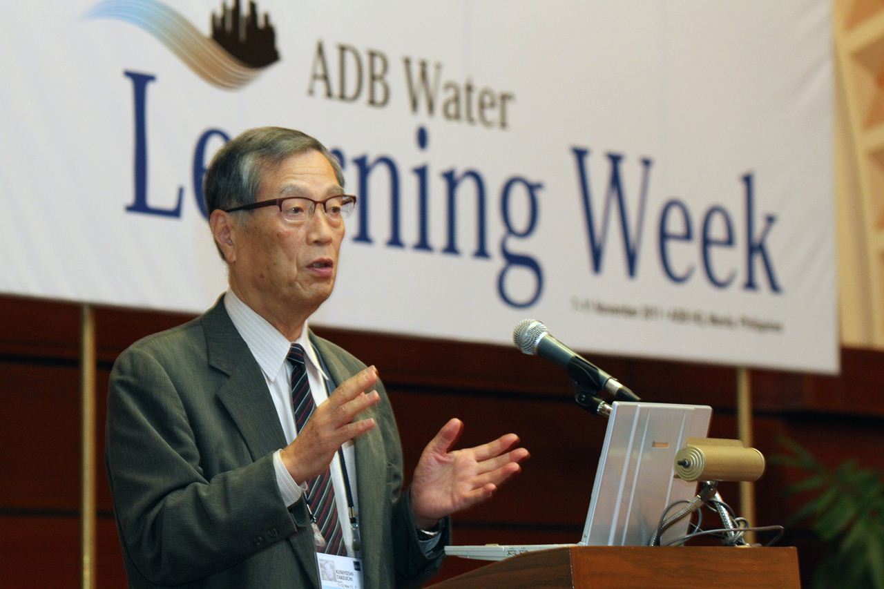
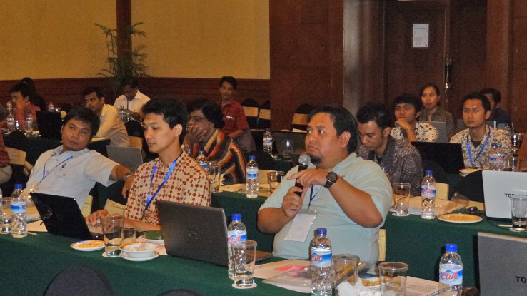
: Greeting speech from ICHARM Director Takeuchi
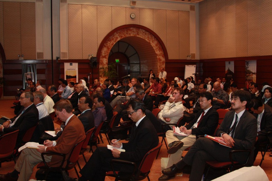
Participants (Nov. 9th, 2011)
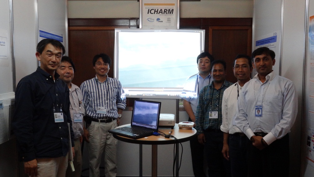
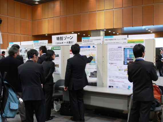
In a special exhibition booth
The Asian Development Bank (ADB) hosted the ADB Water Learning Week for five days, from Nov. 7th to Nov. 11th 2011, at the ADB headquarters in Manila, the Philippines.
Researchers and experts involved with water issues in Asian countries (110 people in 20 countries) gathered and exchanged information with each other.
Among the events, the entire Nov. 9th session was organized by PWRI / ICHARM and ADB. During the session , ICHARM explained and discussed the following topics, focusing on reporting the results of ADB TA7276-REG “Supporting Investment in Water-Related Disaster Management,” in which ICHARM and ADB had a partnership agreement.
•「 Recent water-related disaster situations, including an overview of the tsunami disaster in Japan
•「 Explanations of innovative projects performed by ICHARM in Indonesia, Bangladesh, and Lower Mekong Basin Countries
•「 A panel discussion to show ways to reduce damages in future water-related disasters
In addition, in a special exhibition booth set up at a hall in the ADB headquarters, we published information including a simulation forecasting the flooding in Thailand and a video on the Mar. 11th tsunami in Japan. Many of ADB staff were also interested in our information.
At this event, we were able to show participating countries the appeal of ICHARM’s activities, focusing on the latest research results of ADB TA7276-REG, and also to win high praise from many participants
(Contact: ICHARM)
“Seminar on Snow Avalanche and Landslide Prevention Technique” was held
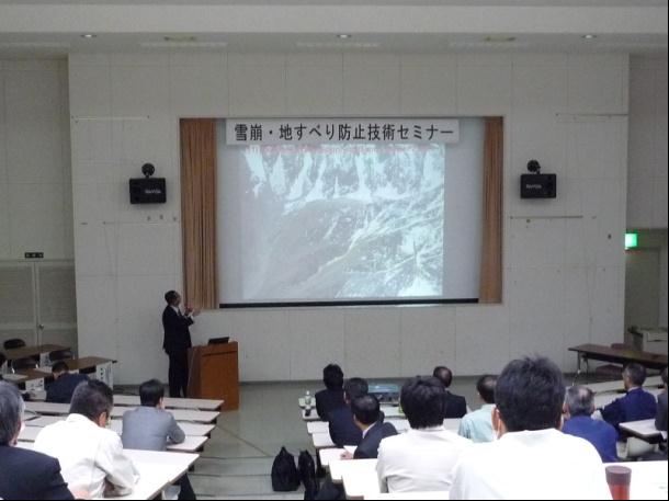
a view of the morning lecture
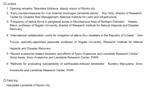
Seminar program
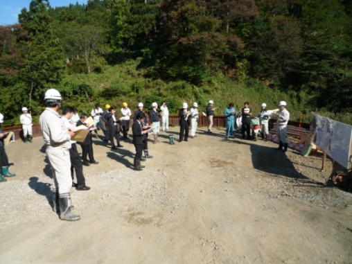
a view of the afternoon field trip
“Seminar on Snow Avalanche and Landslide Prevention Technique” was held in Myoko City, Niigata Prefecture on Oct. 28th, 2011. This event composes a series of seminars aiming to prepare for snow avalanche and landslide-related disasters, which frequently occur in Niigata Prefecture. It also aims to promote persons in charge of disaster prevention to gain better understanding of current situation and issues for disaster prevention plans and works as well as the latest research findings.
The seminar was hosted by Promotional Council for Development of Snow Avalanche and Landslide Research, which is composed of cities in Joetsu and Chuetsu regions, under the auspices of Niigata Prefecture and Yuzawa Sabo Office of MLIT Hokuriku Regional Development Bureau. Research Institute for Natural Hazards and Disaster Recovery of Niigata University and Snow Avalanche and Landslide Research Center also co-hosted the seminar. Since first seminar was held at Yuzawa-machi in 2006, we have held such seminars every year, and this was the sixth seminar.
In this seminar, five experts gave lectures in the morning and a field trip was carried out in the afternoon (Table 1). Engineers and researchers of municipal and prefectural governments and construction consultant companies gathered from various parts of Niigata. 58 and 27 participants attended to the morning lecture and the afternoon field trip, respectively.
In the morning lecture, Koji Goto, director of Research Center for Disaster Risk Management, National Institute for Land and Infrastructure, gave a lecture titled “Early countermeasures for river channel blockages (landslide dams).” He provided many valuable information such as potential risks and triggering factors for landslide dam formation, countermeasures for landslide dams (early countermeasures and emergency measures), and responses to the Typhoon Talas severely damaged Kii Peninsula in September 2011, in relation to the amendment of Sediment Disasters Prevention Act (May 2012). Hideaki Marui, professor of Niigata University, spoke about processes of debris flow occurrence in high altitude and periglacial environment as well as possibility of onsite countermeasures in his lecture titled “Frequency of debris-flows in periglacial zones in Mountainous Area of Northern Pakistan (Photo 1)." Gen Furuya, specially-appointed associate professor of Niigata University, introduced an international collaboration works for mitigation of debris-flow disasters in the Republic of Croatia.
As representation from our research center, Shinji Ikeda (researcher) reported recent avalanche-related disasters which mainly occurred in Niigata and Nagano Prefectures, and the efforts of us to prevent such disasters. Also, Kiyoteru Maruyama (deputy team leader) introduced new methods for evaluating susceptibility of earthquake-induced landslides on previously slid slopes, which he has worked for the last several years as a member of PWRI focus project research. We received various feedbacks from the participants, for example, “through the lectures, I fairly understood the importance of organizing early countermeasures before landslide dams are formed as well as specific countermeasures against landslide dam failures.”
In the afternoon field trip, we visited a landslide which occurred on Apr. 20th, 2011 due to rapid snow-melting, and staff from Myoko Sabo Office of Niigata Prefecture explained the participants the present condition of recovery from the disaster (Photo 2). We are going to continue to hold such seminars to exchange views with persons in various fields and to promote the diffusion of our research findings.
(Contact:Snow Avalanche and Landslide Research Center)
Participated in the Tsukuba 2012 TX Technology Showcase
One minute demonstration
Poster display (Great East Japan Earthquake)
Poster display (Typhoon Talas)
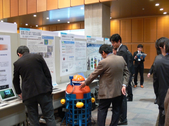
Planning and Management Division and Volcano and Debris Flow Research Team, PWRI participated in the Tsukuba 2012 TX Technology Showcase, which was held in Epochal Tsukuba on Jan. 13th, 2012.
The TX Technology Showcase is an event hosted by the Tsukuba Science Academy where each research institute in Tsukuba Science City displays and exhibits their research. This was the 11th showcase.
PWRI participated in this showcase as we do every year, but this year we came to tell everyone about our responses to the Great East Japan Earthquake and Typhoon Talas disasters last year and how our research was used.
In this event, a total of 109 posters were exhibited in the medium hall, which was almost at full occupancy. Although our demonstration time was limited to only one minute, we were able to introduce PWRI’s water-level observation buoy used for measuring water level fluctuation for natural dams due to Typhoon Talas and to discuss our early countermeasures, including the announcement of the estimated damage area using its buoy.
We also discussed that we dispatched experts to disaster areas right after the Great East Japan Earthquake occurred, and how they performed various actions such as damage investigation and technical assistance towards reconstruction.
After this discussion, the poster was displayed at a different location. Many visitors participated in the “core time” portion, where researchers explained their research results directly to visitors.
Each of PWRI’s booths had many visitors, demonstrating the high level of interest in disaster countermeasures. In particular, PWRI’s actual water level observation buoy attracted the attention of many visitors.
PWRI will also continue doing its best to ensure and assist the stable lives of citizens. We will participate in this kind of event in the future in order to publicize our research.
(Contact: Planning and Management Division.)
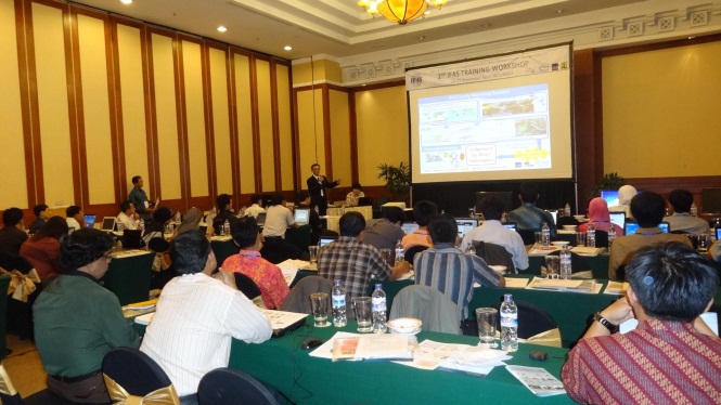
Report on workshop held in Solo, Indonesia
Participants listening to the presentation on the Solo project
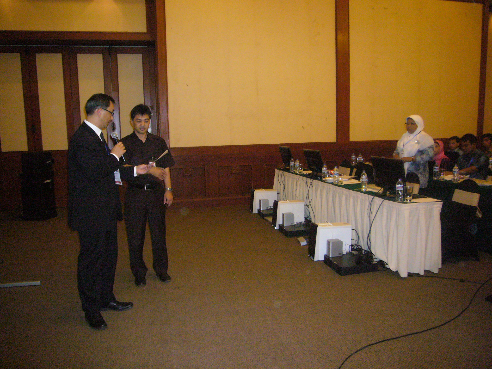
Team leader of ICHARM is announcing the transfer of three computer sets to Bengawan Solo river Agency, Directorate General of Water Resources, Ministry of Public Works, Indonesia
A participant asking questions about the new flood warning system
As a part of the ADB TA7276-REG project, ICHARM has been carrying out the implementation of a flood early warning system in Indonesia by using the Integrated Flood Analysis System (IFAS) developed by ICHARM. In this local project, ICHARM organized an IFAS training workshop from Nov. 23rd to 25th 2011 in Solo (Surakarta), Indonesia, rent three sets of computers to the Solo River Basin Agency, Directorate General of Water Resources, Ministry of Public Works, Indonesia and installed an IFAS-based flood early warning system for the Solo River basin.
During the workshop, ICHARM researchers made a presentation on this implementation project and provided lectures and practices on the operation of the IFAS flood early warning system. Participants learned the importance of making frequent observations and repeating analysis by reflecting optimized parameters in order to get more accurate results for safer evacuation. Some of the participants quickly learned how to tune IFAS parameters and were able to get highly accurate results.
The new flood early warning system upgraded with IFAS is expected to help the local communities mitigate flood damage in the Solo Basin more effectively.
Below is the list of main organizations of workshop participants:
Water Resources Authority, Indonesia
Solo River Basin Agency, Directorate General of Water Resources, Ministry of Public Works, Indonesia
Climatological Meteorological and Geophysical Agency, Indonesia
Bangladesh Water Development Board
Disaster Management Bureau, Bangladesh
Mekong River Commission
(Contact:ICHARM)
Quick response-type simulation for Thai flood using satellite-based data
Results of flood forecasting using the RRI model as of Oct. 21st
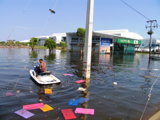
The flooding situation in an industrial complex as of Nov. 11th
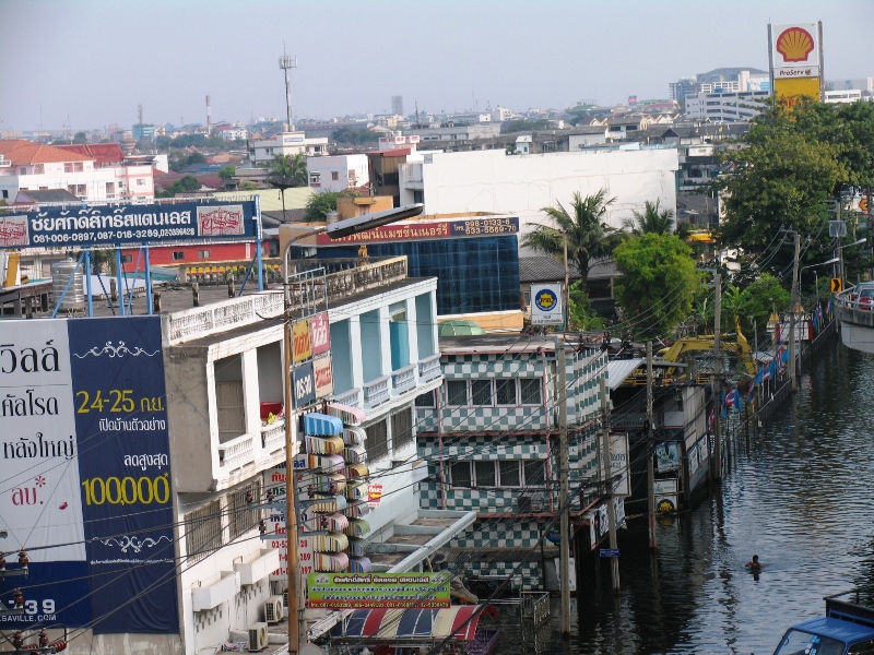
The flooding situation in northern Bangkok as of Nov. 11th
From summer through autumn 2011, flooding in the Chao Phraya River basin in Thailand caused severe damage to agriculture, industry, and urban life across large parts of the basin. In mid-October 2011, when flood damage was at its peak, ICHARM conducted a quick response-type flood simulation. In this simulation, we used Rainfall-Runoff-Inundation model (RRI Model) that simulates subsurface, surface flow and river flow simultaneously. The model calculates the exchange of water between floodplains and rivers to calculate the processes of flooding from rivers and returning of flooded water from floodplains to rivers where no significant embankment exists. We used the RRI Model together with satellite-based topographic and rainfall information to simulate river discharge and flooding over the entire Chao Phraya River basin. Furthermore, we input rainfall forecasted by the Japan Meteorological Agency to estimate how the flooding would expand and continue. Although the predictions varied depending on the settings, we estimated that the flooding in the Ayutthaya area might even last until the end of November.
We regularly updated the simulation and released the results on our webpage. Some of these calculations were reported by various mass media outlets, including NHK, and people were reminded of the prolonged flooding. In addition, we conducted field investigations in November to understand flood situations as well as to validate the simulation results. Overall, the simulation results including the estimate mentioned above were generally correct; however, it also became clear that there was difficulty in long-term prediction, especially as the flood magnitude gets smaller and the impact of artificial structures gets larger. We are now conducting simulation using detailed filed data to study future flood countermeasures.
Since this flood disaster, JICA launched a new project: "Project on a Comprehensive Flood Management Plan for the Chao Phraya River Basin", in which ICHARM is also involved as a Japanese supporting member. We are in charge of the first analysis of flood control countermeasures. Through this activity, ICHARM will work and conduct further research toward reducing flood risk in this region.
URL http://www.icharm.pwri.go.jp/news/news_j/111024_thai_flood_j.html
(Contact: ICHARM)