The Integrated Flood Analysis System (IFAS) is designed to help create a runoff analysis model easily by using topographic and land-use data which cover almost the entire globe and are available free of charge via the Internet.
With IFAS alone, users can conduct a series of tasks necessary for runoff analysis including data acquisition, model creation, rainfall-runoff analysis and result display. With an additional module named Auto-IFAS, the system is capable of executing automatic functions such as downloading satellite rainfall information, loading ground rainfall information, performing runoff calculation, and issuing a warning. With these functions, users can built a real-time flood forecasting and warning system though they are minimal for a device with such a purpose.
IFAS with this additional module is very useful even in areas with limited Internet access. It can perform calculation while collecting data regularly according to a predetermined time schedule. In this way, the network and the computer can avoid being overloaded with information processing, which thus enables fast runoff calculation and quick flood forecasting and warning.
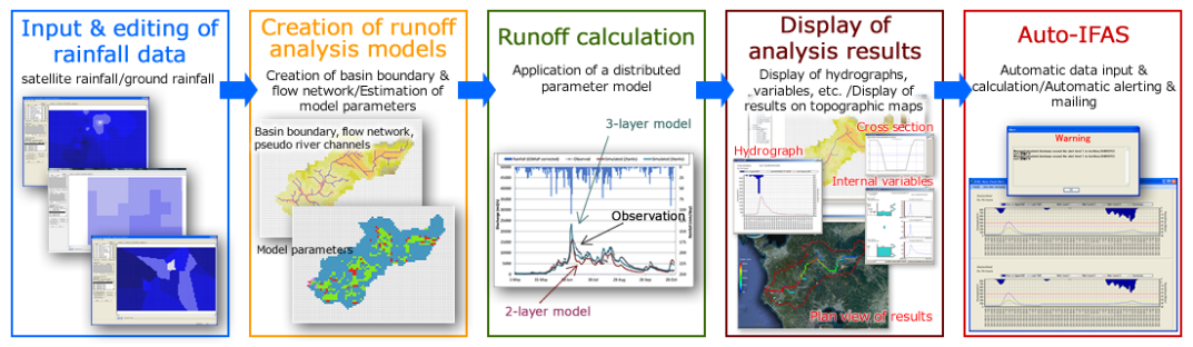 Calculation flow of IFAS
For more information, please visit here.